Tools
MapGuide
A map for saved places, route planning and workout tracking, plus AI-built tours you can publish.
Tools
What it does
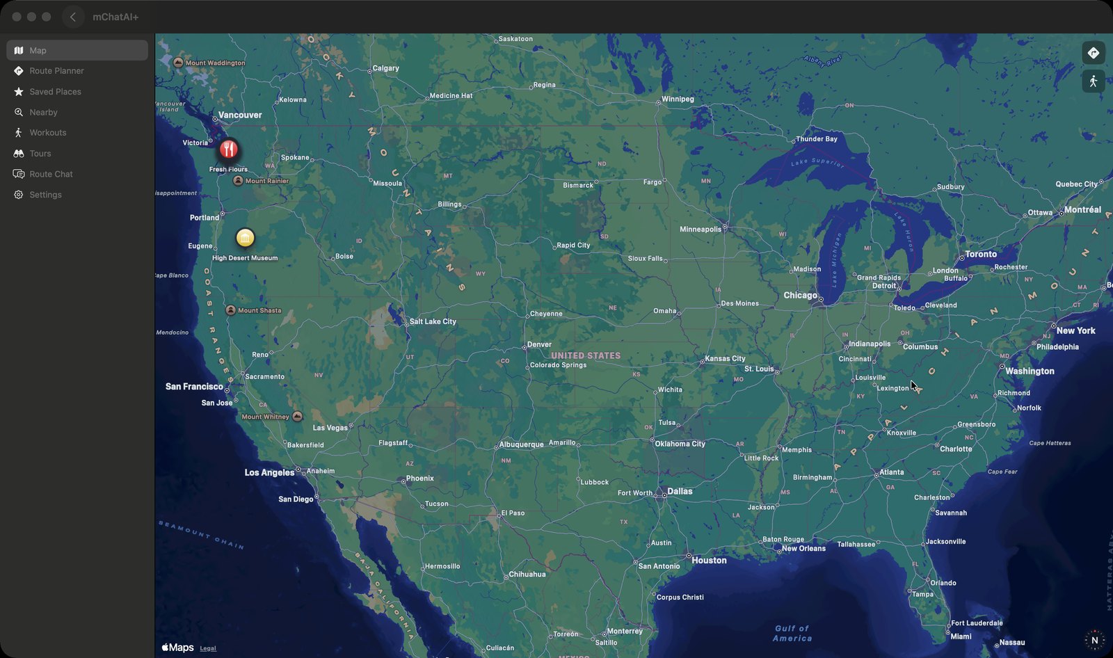
- An eight-tab sidebar over a MapKit map — Map, Route Planner, Saved Places, Nearby, Workouts, Tours, Route Chat, Settings — with saved places, discovered places and workout breadcrumbs all drawn on the same map.
- Route Planner geocodes a start and destination, returns several route options with trade-off chips, and lets you set travel mode (walking, running, cycling, driving, transit), route type, "Avoid Tolls" and "Avoid Highways". The option you pick is saved to a list of recent routes.
- Opening a saved or discovered place and pressing "Directions" draws a route line from your current location to it on the map.
- "Nearby" searches around your location and lists results with the distance to each; right-clicking one offers "Save Place", "Open Website" and "Open Wikipedia".
- Tours: "Start a Tour" takes a location, source toggles (Wikipedia, Apple Maps POIs), category filters and a stop count, pulls candidates from both sources and merges duplicates. Stops that came with a Wikipedia summary get a short narration written by a model. You then reorder, edit or add stops in the builder and read through them with "Test Play".
- Tours publish to the Community Hub with an auto-generated map snapshot as the cover and can be unpublished again; "Browse Map Tours" installs tours other people published.
- Workouts start from a button on the map, show live distance with Pause and Stop while running, and finished sessions land in a Workout History list with distance, duration and elevation gain.
How to try it
- Open the "MapGuide" tile from the "Tools" band on the home screen and allow location access when macOS asks.
- Click "Tours" in the sidebar, then "Start a Tour" — pick a location, leave "Wikipedia" and "Apple Maps POIs" on, choose categories, and press "Continue".
- In the tour builder, add stops with the search field or "Curate Stops Around Here", then press "Test Play" to step through each stop's narration.
- Click "Route Planner", press "New Route", type a destination, press "Calculate Route", pick one of the options and press "Save Route".
Works with
- Community Hub — publish, unpublish and install tours
- The iOS app — tours and saved places are written to CloudKit by MapGuideStore
- Wikipedia and Apple Maps points of interest, as the two tour-stop sources
- Deep links from elsewhere in the app: a place recommendation artifact with a coordinate sidecar opens MapGuide centred on that spot with a pin
Drive it from an agent
These commands are callable by Claude Code, Codex, or any agent talking to mChatAI+ through the portal:
mapguide.geocode
mapguide.discoverPlaces
mapguide.getState
mapguide.snapshot
MapGuide ships with mChatAI+. Native macOS app. Your own API keys, or fully on-device. Get mChatAI+